
Genoa subport Tunnel
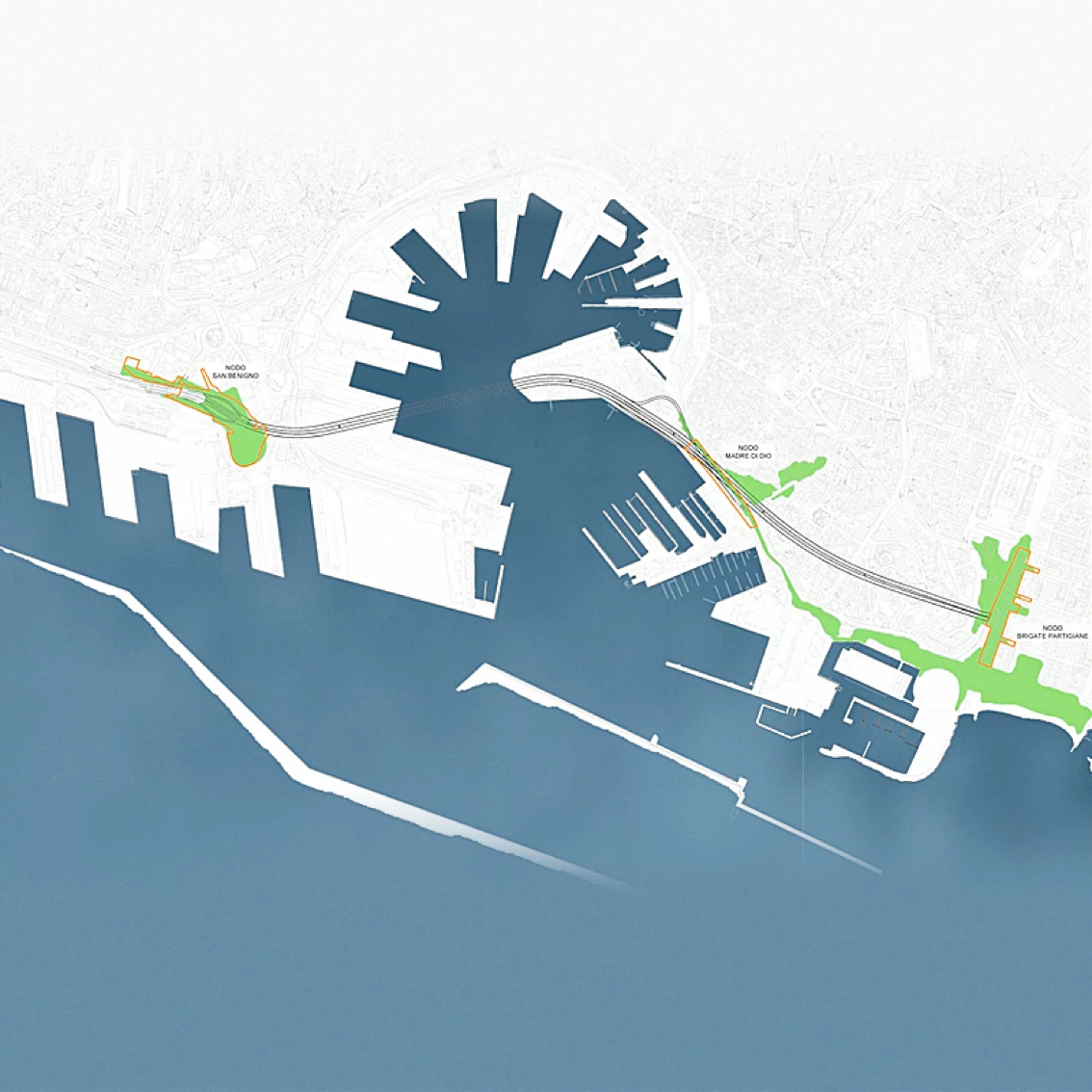
The tunnel is approximately 3.4 km long, from the San Benigno junction, in the west, to Viale Brigate Partigiane in the Foce district, eastward, passing under the port basin.
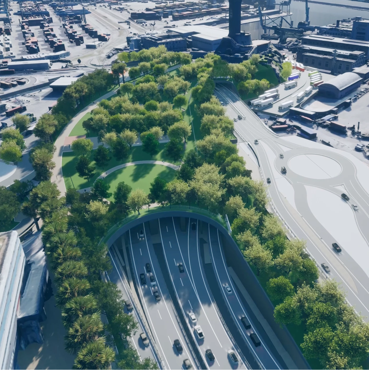
The tunnel will consist of two separate main tubes, one for each direction, constructed by mechanised excavation. On the western side (Lato Ponente), the tunnel is connected to the road system of Lungomare Canepa and, from there, to the Genova Aeroporto (A10) motorway exit through the Guido Rossa motorway. The connection with the Genova Ovest (A7) exit is instead guaranteed through the road system of the new San Benigno junction. On the eastern side (Lato Levante), the connection to the city road system is on Viale Brigate Partigiane, following the current connection guaranteed by the Sopraelevata Aldo Moro. In the central area of Porto Antico, the new route connects with the Via Madre di Dio roadway through a specific junction.
History and context of the asset
The hypothesis of a road tunnel under the basin of Genoa's Porto Antico came together in 2000 and developed over the following five years. This resulted in a preliminary design developed in 2003 and approved by the Higher Council of Public Works in 2005. In 2006, the Ministry of Infrastructure and Transport included it among the Strategic Infrastructures.
In 2021, the project was revived, becoming part of a set of interventions aimed at satisfying the public interest and defined in the Agreement between Autostrade per l'Italia, the Liguria Region, the Western Ligurian Sea Port Authority and the Municipality of Genoa signed on 14 October 2021.
To make the design of the Tunnel consistent with the context, a collaboration with RPBW Renzo Piano Building Workshop was activated, with the aim of seizing an extraordinary opportunity for the city of Genoa, not only in terms of cutting-edge engineering and the strengthening of road connections between the Western and Eastern city, but above all for the possibility of recovering and redeveloping the areas of the city where the Tunnel returns to the surface and becomes part of the urban structure.
The asset
The project consists of a road crossing of the inner basin of the port of Genoa through the construction of two tunnels and the relevant connections with the motorway and the city road network westward (San Benigno area) and eastward of the city centre (Viale Brigate Partigiane area). The project is motivated by the need to improve the efficiency of the fast road link across the city, currently constituted of the Sopraelevata built in the early 1960s, which can no longer meet the traffic needs of the city, resulting from the urbanistic changes that have affected the west, the old port and the city centre, and those being implemented in the east.
Tunnels
Each of the two main tunnels will be excavated by mechanised tunnelling, using a Hydroshield type TBM with face pressure. The excavation diameter will be approximately 16m. This technology allows excavation in inconsistent soils even in the presence of groundwater, and can adapt to the variability of the geotechnical context along the route.
The external diameter of the prefabricated ashlar ring is 15,4m and the thickness of the ashlars is 0,55m, with an internal diameter of 14,3m.
The ashlars will be connected using bolts between the longitudinal joints (ashlar-ashlar) and connectors between the transverse joints (ring-ring) and fitted with an EPDM rubber gasket in order to guarantee the hydraulic seal. An additional 0,25m-thick cast-in-place concrete ring-ring lining was provided in order to ensure the complete hydraulic tightness of the section, particularly in the areas underneath the port basin. Between the prefabricated ashlar ring and the in-situ lining will be the waterproofing sheet.
Urban regeneration
“Arriving in the city will be marked by the presence of large public green spaces. The cars will gently become part of the neighbourhoods while maintaining public enjoyment of urban spaces by pedestrians””
RPBW
The image of Genoa from the sea is characterised by large green areas starting from the Forti di Genova and reaching the coast in a fragmented but constant way from Levante to Ponente.
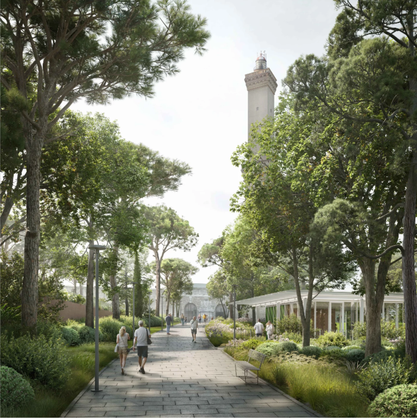
The urban design of the new Sub-Port Tunnel aims at contributing to the reinforcement of this image of the city by stitching up man-made areas with the construction of three new public parks and a network of pedestrian-cycling routes capable of enhancing the pre-existing areas where the Tunnel returns to surface.
The urban interventions that are thus emerging all have different dimensions and urban scales, but at the same time represent strategic steps for the development of the city and its sustainable evolution.
More specifically, the project envisages three major works: the reconnection between the Lanterna, symbol of Genoa, and the Sampierdarena area, the northward expansion of the Parco della Foce, thus making it the largest park in the city, and the recovery of the historical walls of Corso Aurelio Saffi, hidden over the years by the construction of a set of superstructures.
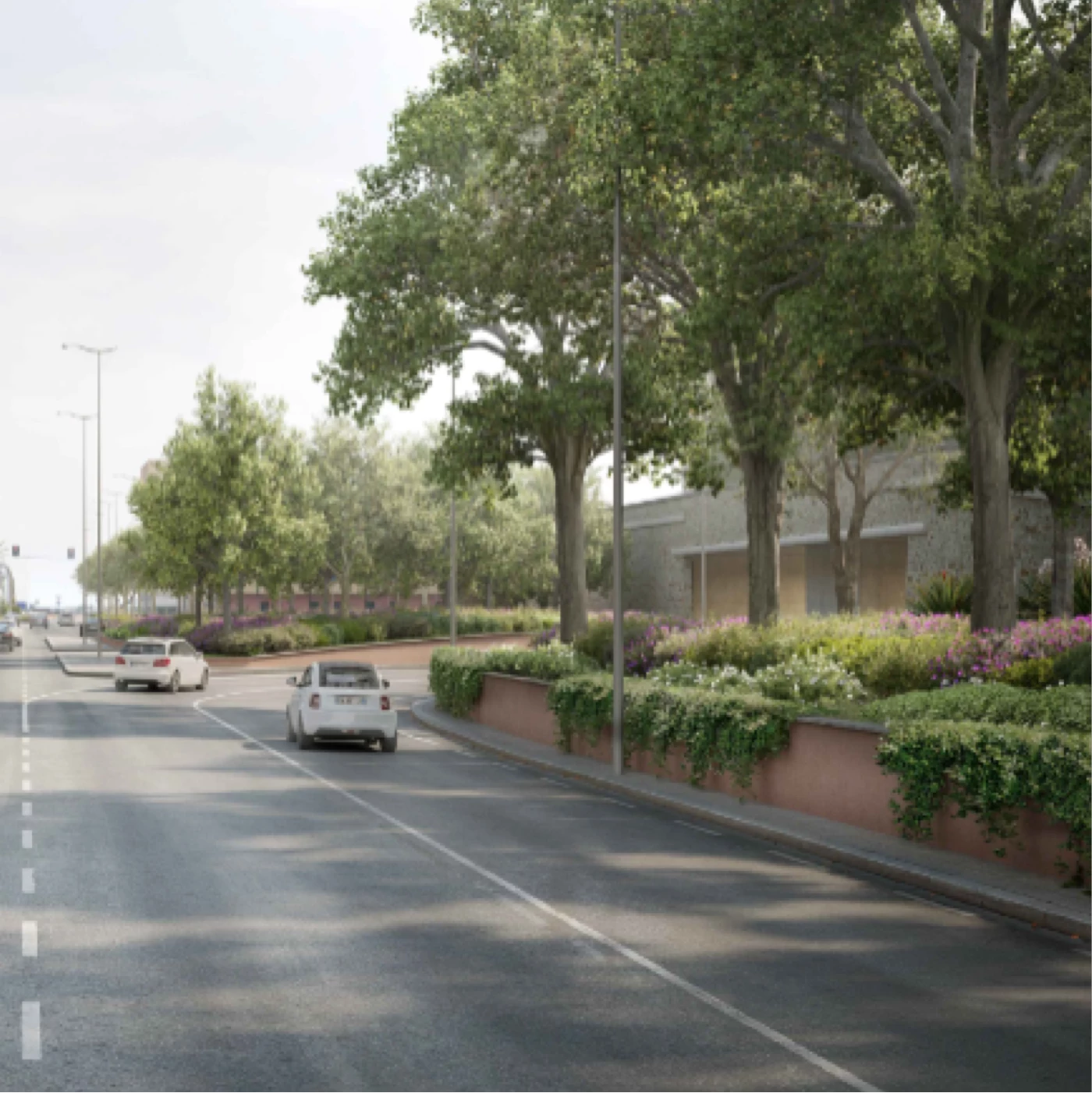
Parco della Lanterna
Parco della Foce
Parco delle Mura
Parco della Lanterna
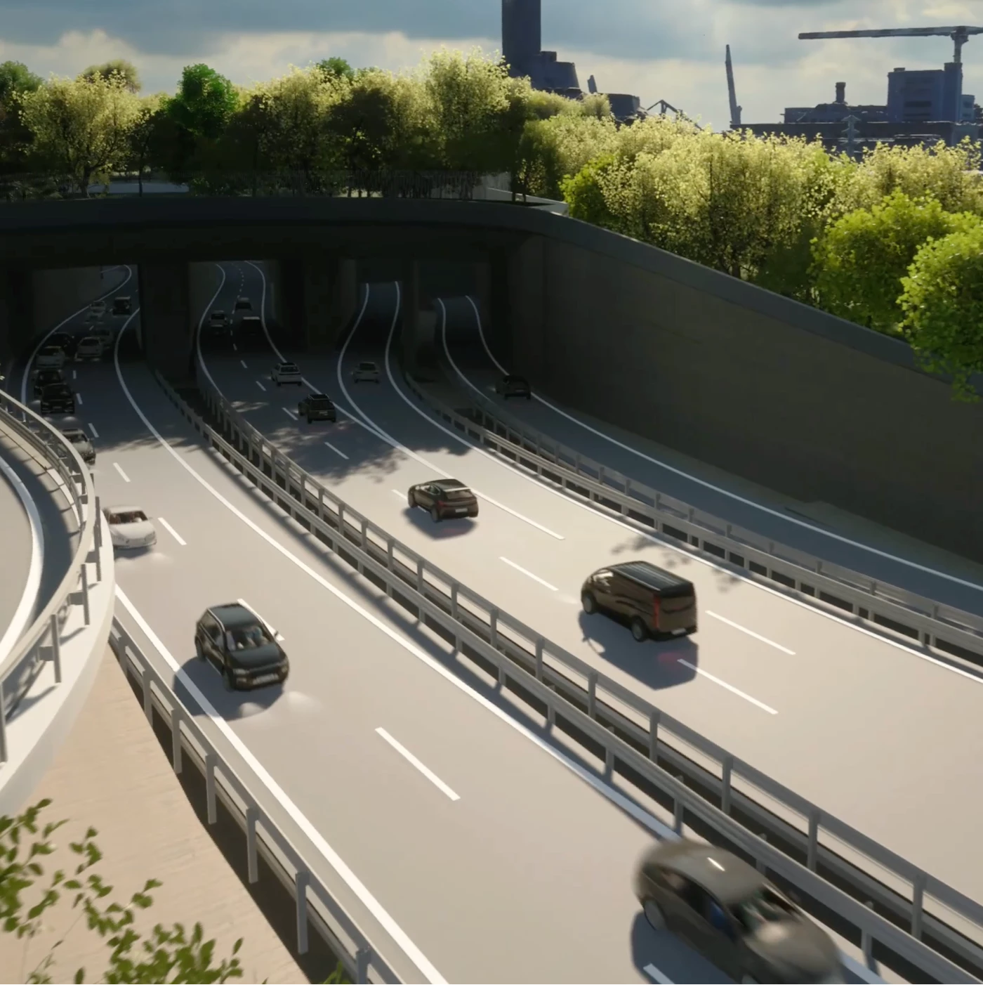
The Parco della Lanterna will represent the arrival point of the cycle and pedestrian path coming from the Porto Antico; at the same time, it will be the starting point westwards, through the Lungomare Canepa upgrading project. The green areas the park will have different functions so that they can be used for public events and demonstrations, for individual sports, and for children's play and leisure time. Above all, from the park will give residents of Sampierdarena the possibility to enjoy the view of the sea and the entire harbour basin
Parco della Foce
The remodelling of the Viale Brigate Partigiane roadways will allow the Parco della Foce to be extended northwards, thus creating an urban park extending from the city centre to the urban beach of Piazzale Kennedy. This will make it the largest park in Genoa. Tall trees will line the pedestrian walkways, bicycle paths and driveways so that there will always be filters of greenery within the road sections. Consistently with the pre-existing naturalistic ecosystem, the vegetation will complete and reunite the existing rows of plane trees in the avenues of the Foce district with the tree wealth of the Francesco Coco gardens.
Parco delle Mura
Arriving in the city and exiting the tunnel will be characterised by the presence of green areas accompanying the road beyond the walls, passing through privileged viewpoints of rationalist buildings, such as Marcello Piacentini's skyscraper, of historic buildings, such as the Mura delle Grazie and Mura della Marina districts, and finally the Giardini Baltimora.


